Blue Ridge Parkway History
The Blue Ridge Parkway is a National Parkway and America’s Scenic Drive in the United States, noted for its picturesque mountain beauty to the more than 600 million visitors. It runs for 469 miles (755 km) through the famous Blue Ridge Mountains, a major mountain chain that is part of the Appalachian Mountains.
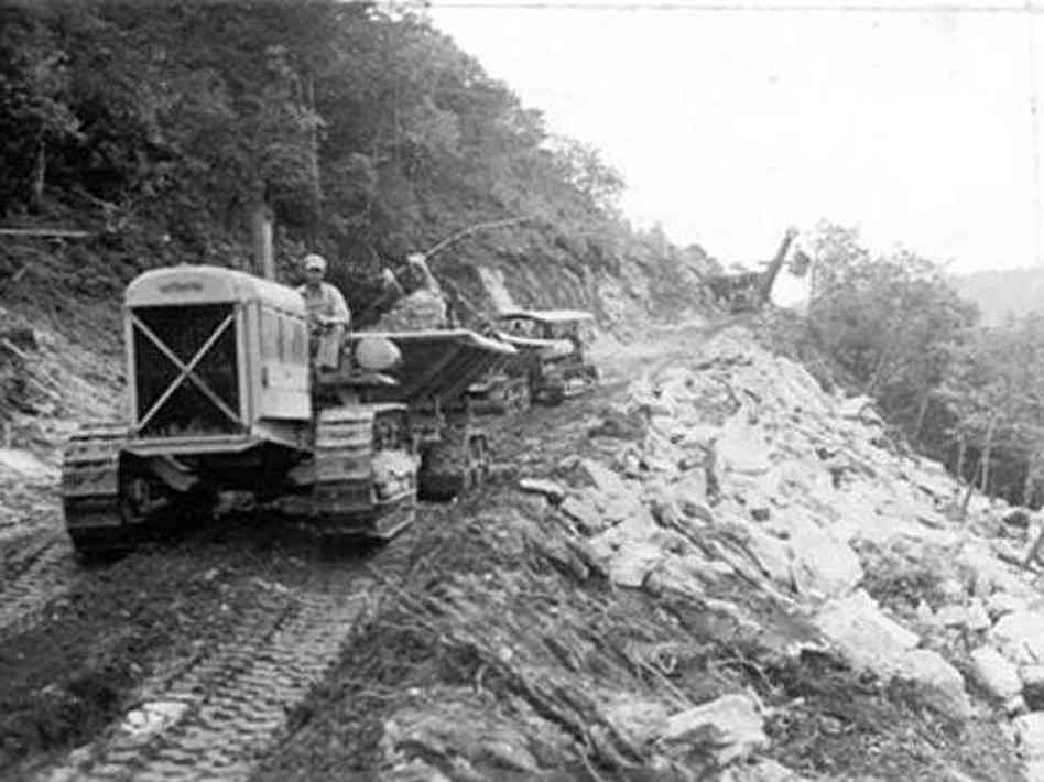
The Blue Ridge Parkway history began as a public-works project to combat the crippling economics of the Great Depression and was realized during the administration of U.S. president Franklin D. Roosevelt, actual construction of the Parkway didn’t begin until 1935. At that time, President Franklin D. Roosevelt had visited Virginia’s first Civilian Conservation Corps camp while they were working on the Skyline Drive through Shenandoah National Park in Virginia. Liking what he saw, he soon approved the concept of constructing a scenic motor way linking the two new parks, Shenandoah and the Great Smoky Mountains National Park. Roosevelt decided that the Parkway should follow the crest of the southern Appalachian mountains through Virginia and North Carolina. The project was originally called the “Appalachian Scenic Highway.”Most construction was carried out by private contractors under federal contracts under an authorization by Harold L. Ickes in his role as federal public works administrator. Work began on September 11, 1935 near Cumberland Knob in North Carolina; construction in Virginia began the following February. On June 30, 1936, Congress formally authorized the project as the ” Blue Ridge Parkway” and placed it under the jurisdiction of the National Park Service.


The Blue Ridge Parkway has 27 tunnels that were constructed through the rock; one in Virginia and 26 in North Carolina. Sections of the Parkway near the tunnels are often closed in winter. Due to dripping groundwater from above, freezing temperatures, and the lack of sunshine, ice often accumulates inside these areas even when the surrounding areas are above freezing. The highest point on the parkway (south of Waynesville, near Mount Pisgah in North Carolina) is 6047 feet, and is often closed from November to April due to inclement weather such as snow, fog, and even freezing fog from low clouds. The roadway is not maintained in the winter, and sections which pass over especially high elevations and through tunnels are often impassable and therefore closed from late fall through early spring. Weather is extremely variable in the mountains, so conditions and closures often change rapidly. The parkway is carried across streams, railways ravines and cross roads by 168 bridges and six viaducts.
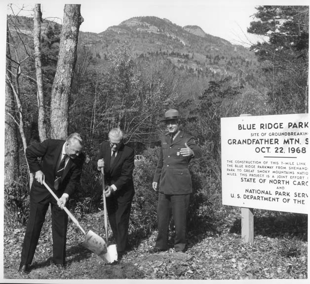
Progress was steady until World War II when funds were diverted for the war effort. The 1950s and 1960s saw a slowdown in construction, until by 1968 the only task left was the completion of a seven-mile stretch around North Carolina’s Grandfather Mountain. In order to preserve the fragile environment on the steep slopes of the mountain, the Linn Cove Viaduct, a 1,200-foot suspended section of the Parkway, was designed and built. Considered an engineering marvel, it represents one of the most successful fusions of road and landscape on the Parkway. Construction of the parkway took over fifty-two years to complete, the last stretch near the Linn Cove Viaduct was completed around Grandfather Mountain in 1987. In that same year the 469-mile Blue Ridge Parkway was officially dedicated on September 11, 1987.

The parkway runs from the southern region of the Shenandoah National Park’s Skyline Drive in Virginia at Rockfish Gap to U.S. 441 at Oconaluftee in the Great Smoky Mountains National Park near Cherokee, North Carolina. There is no fee for using the parkway, however commercial vehicles are prohibited. The speed limit is never higher than 45 mph (70 km/h) and lower in some sections. The parkway uses short side roads to connect to other highways, and there are no direct interchanges with interstate highways, making it possible to enjoy wildlife and other scenery without stopping for cross-traffic. Mileposts along the parkway start at zero at the northeast end in Virginia and count to 469 at the southern end in North Carolina. The mileposts can be found on the west side of the road. Major towns and cities along the way include Waynesboro, Roanoke, and Galax in Virginia; and in North Carolina, Boone and Asheville, where it runs across the property of the Biltmore Estate.
